Regional Profile - Example: Planning for Utilisation of Unused Treated Wastewater
 |
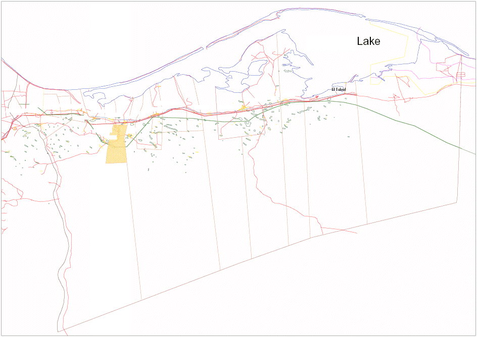
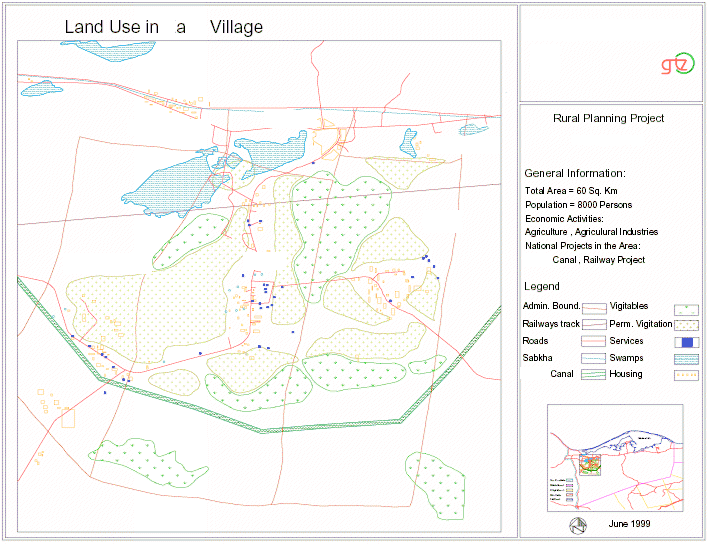
The Regional Planning Unit was requested to make a land use plan for a village, with special reference to the expected impact of two large national projects that impact on the main district. The two national projects are the water Canal and the Railway track. The village is located in a land depression located between the main road. The new railway will pass through the north of the village while the Canal is currently being constructed close to the village. The village is largely an agricultural village. Due to the land elevation in the village there was a potential problem with regard to the effects of the drainage water as a result of the agricultural land to be irrigated through the canal. After analysing the characteristics and history of the village and the surrounding villages, it turned out to be that the whole basin had been spatial ordered into a single village in the past. Recently it was divided into 3 villages. Initially, the planning unit was requested to develop a development plan for the village only. However, after examining the data and information, the planning unit found it necessary to develop a plan for the whole basin, which includes the village. The data and information (socio-economic, physical, etc.) that was collected by the unit provided an interesting insight into the fact that the all the villages in the basin were closely linked to each other, they acted similar to a multi-nucleus settlement. Close linkages and dependencies exist between the people living in the various villages both economically and socially. The proximity of the villages and the fact that they are located in the same basin are just one of the reasons for the close inter-linkages between the villages in the basin. The following data and information was collected as part of the regional profile for the whole basin, including the village. |
 |
Map 1: Location of the Village
|