Merging MS Excel Tables and Charts into ArcView - Example: Development of a Population Atlas
 |
The development of a population atlas for the area was a considerable achievement, given the data restrictions that the project faced. Not only was it a difficult to acquire reliable population baseline data but it was also a challenge to project the data. Rather than trying to use a complicated relational database programme, the planning team in the area opted to use a spreadsheet programme (e.g. MS Excel). One of the main reasons for the choice was the fact that the technical staff were largely familiar with using spreadsheet programmes and the additional training needed to use it in combination with the GIS programme was limited. The following main steps were undertaken by the planning team:
|
 |
Although MS-Excel has many outstanding graphical features the data cannot be integrated into a spatial map. In order to be able to do this the data has to be linked to a GIS programme (e.g. ArcView). An impressive array of maps can be produced when combining the two programmes. In the following examples each of the programmes illustrates how the planning team used information contained in ArcView and matched this without data and graphics contained in MS-Excel. A further advantage of the procedure was that the illustrations and maps could be printed in the local language through the use of supporting software. The combination of MS Excel, ArcView and a software supporting the local language provided the necessary functionality.
Figure 3: Population Density Chart created with ArcView
|
 |
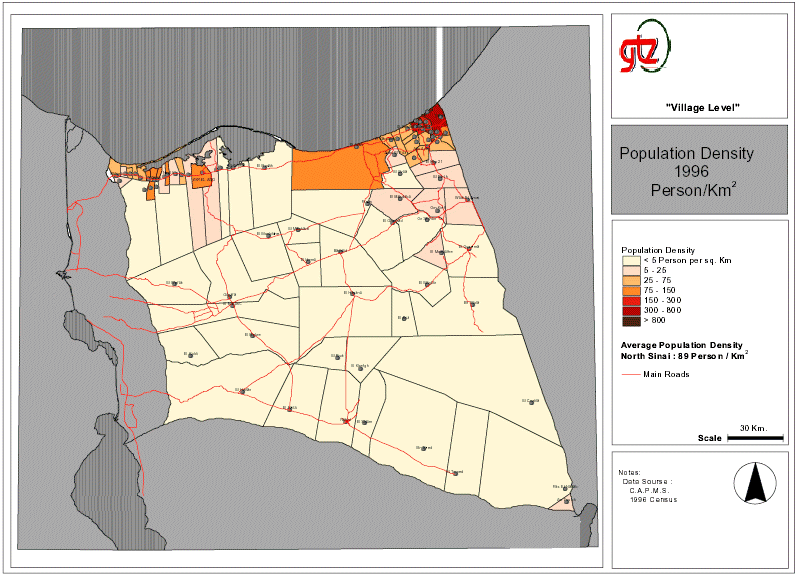
Figure 1 on page 1 shows clearly how illustrations from Excel can be used in combination with ArcView. Furthermore, there is an additional advantage of printing ArcView illustrations in Arabic language using supporting software (i.e. ArabView). Figures 4 and 5 show further examples of an application of this method. Map 1: Population Density
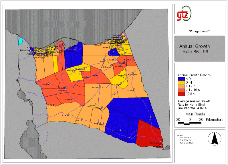
Map 2: Annual Population Growth
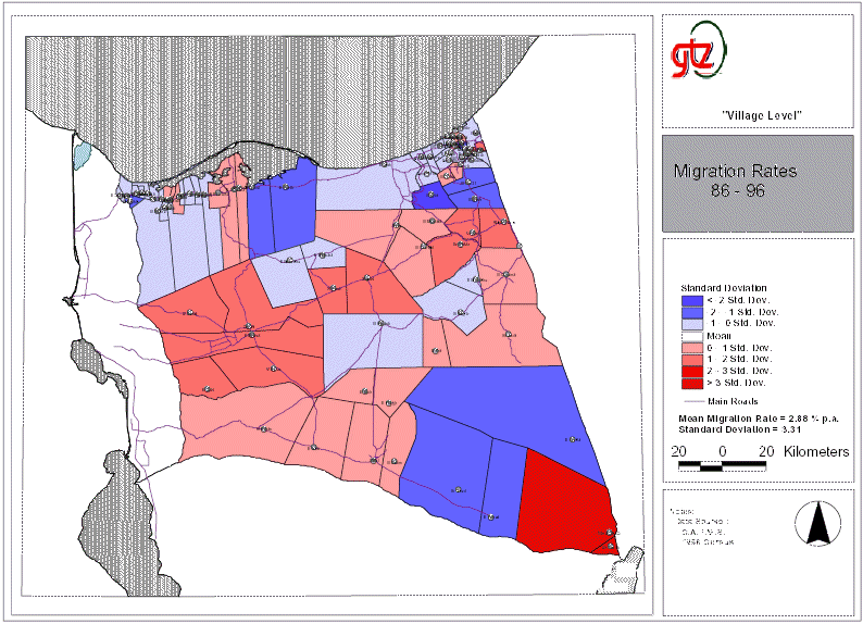
Map 3: Migration Rates
|