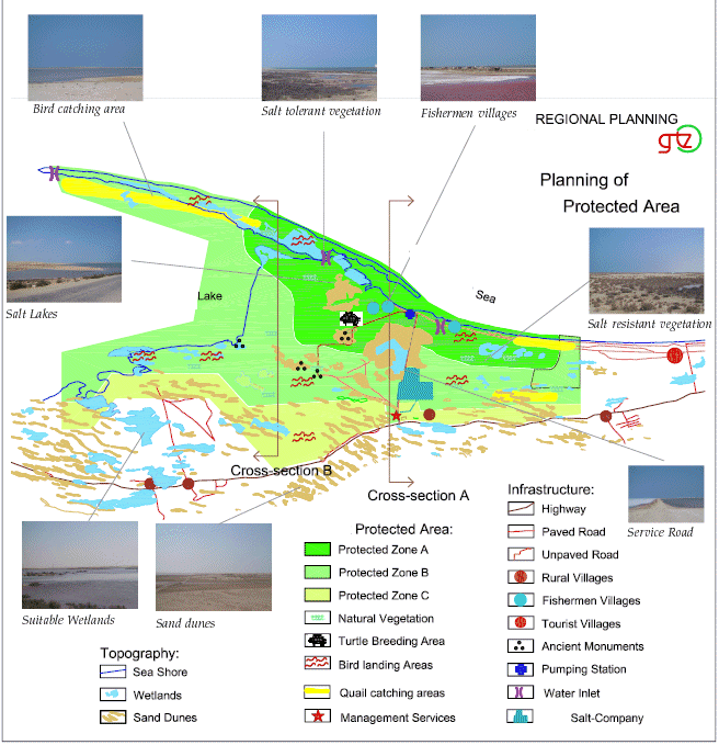
Transect Analysis - Example: Transect of a Protected Area

files/images_static/practitioner.jpg

In the project, participatory planning processes were used successfully on a number of different occasions, including:

  • Transect of the area East of the city: The purpose of the transect was to determine the tourism potential of the area. The transect was undertaken by members of the planning unit together with local residents and community members
  • Transect of the protected area: In order to verify the information gathered on the protected area through other secondary data sources, the planning unit also conducted a transect walk through the protected area. This information was then integrated into the planning options that have been developed.


Map 1: Transect Map of the Protected Area

files/images_static/bulp.jpg

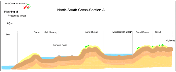
As described in Map 1, two cross-sections have been analysed during the transect. The following features have been identified at the cross-sections of the protected area.


Figure 2: North-south cross section west of the protected area
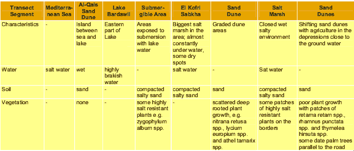
files/images_static/finger.jpg

Table 1: Transect A

files/images_static/result.jpg

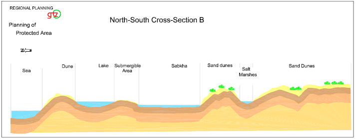
Figure 3: North-south cross section west of the protected area


Table 3: Transect B