Map Production Using Aerial Photographs / Satellite Imagery - Brief Description
|
|
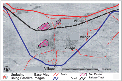
In many regions in Developing Countries topographic maps are not easily available or they are of low quality. Factors affecting the low quality of maps include the fact that the maps are out of date or some or many features are not displayed in the correct way, mostly due to incorrect procedures of data collection or classification. Updating the existing GIS data is important in order to improve the accuracy of the maps and thus the planning documents. Satellite images and aerial photographs present a view of the features of the earth and they offer a useful method for improving existing maps or for creating new maps. Maps are updated by digitizing the features from the satellite images. The technical procedures for improving the accuracy or creating new maps largely depend upon the availability of map data and aerial photography / satellite images. Field verification of the precise classification of identified features extracted from aerial photographic and satellite data has to be undertaken on the ground. This is commonly referred to as “ground-truthing” and it requires on-site inspections. Map 1: Updated Katia Base Map by using satellite images
|
